Rosso, P. H., J. T. Cronin and R. D. Stevens. 2008. Monitoring the invasion of Phragmites australis in coastal marshes of Louisiana, USA, using multi-source remote sensing data. Remote Sensing for Environmental Monitoring, GIS Applications and Geology. VIII. Proceeding of SPIE. Michel, U., D. L. Civco, M. Ehlers and H. J. Kaufmann, Eds. The International Society of Optical Engineering, Bellingham, WA.
ABSTRACT
The rapid spread of P. australis (common reed) in North American marshes is having substantial impact on marsh ecosystem structure and function, displacing native plant species, and reducing the quality of wetland habitat for migratory waterfowl and wading bird species, and a variety of other species.
Mapping the invasion of P. australis using remote sensing has proven to be a difficult task due to difficulties in discriminating between spectrally similar species and due to limitations on data spatial resolution. We propose the use of more advanced technologies, such as lidar, in combination with multispectral imagery to produce accurate maps of this invasive species.
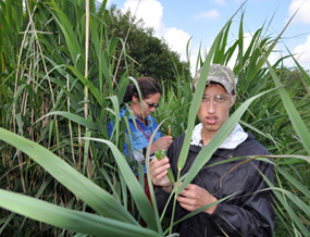
A study area in the marshes of the Rockefeller Refuge in western Louisiana of approximately 1300 ha was selected to be used for a pilot test. This area is characterized by the presence of patches of common reed of diverse size and shape. Morphological features of P. australis, mostly its characteristic height, were used to discriminate this species against other species using high resolution lidar data. Tall, non-vegetation terrain features were identified through multispectral digital aerial photography and combined with lidar through a segmentation and classification approach, to map the distribution of P. australis. Comparisons of resulting maps with preliminary ground surveys showed not only that mapping approach was highly accurate, but also that it was possible to predict the occurrence of patches whose existence was previously unknown.
This approach will be tested in other areas to produce a standard, fully automated protocol to be used with data to be generated in the near future. The monitoring results will be compared to historical data to develop models to link the invasion of P. australis tohurricane events and other disturbances.
Keywords: Lidar, multispectral data, object-oriented classification, segmentation, coastal marshlands, Phragmites invasion